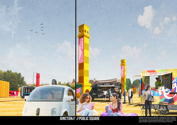
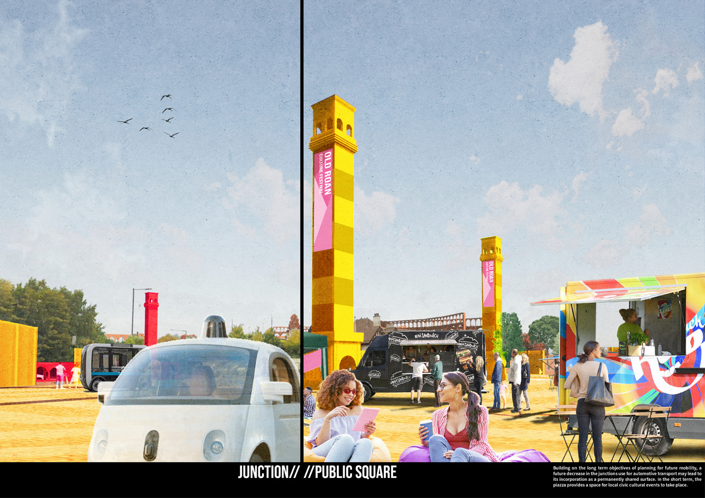
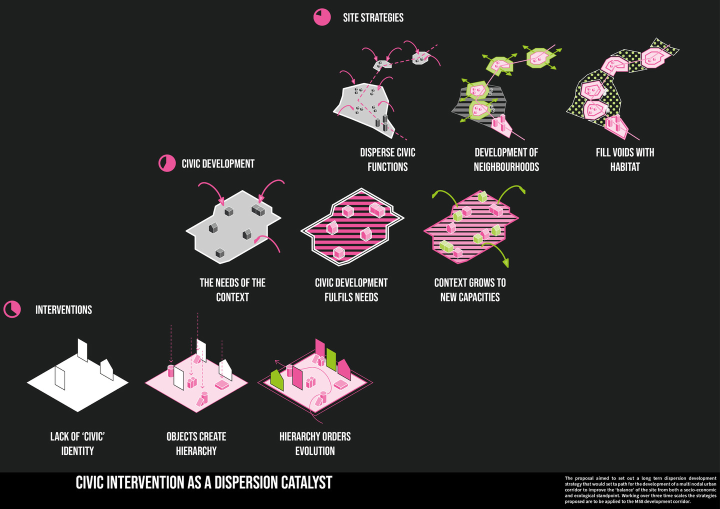
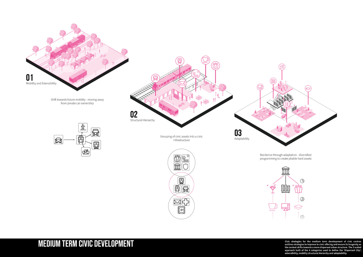
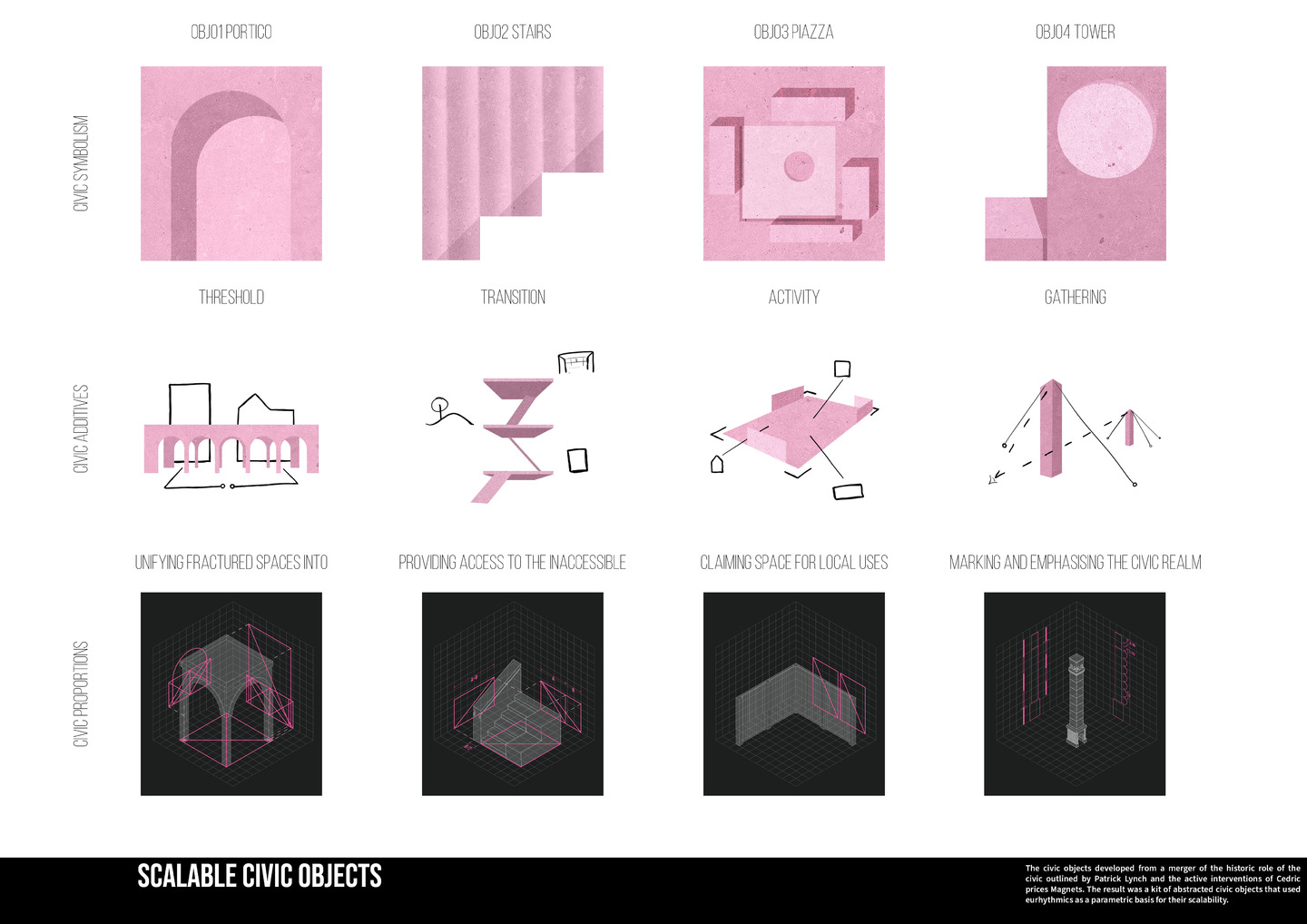
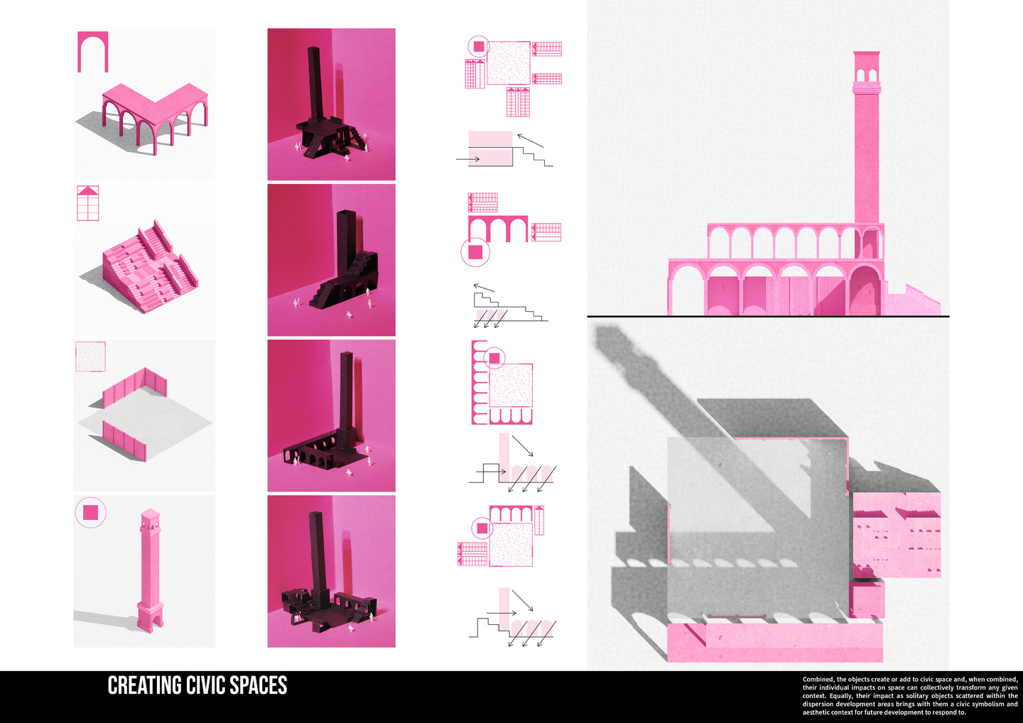
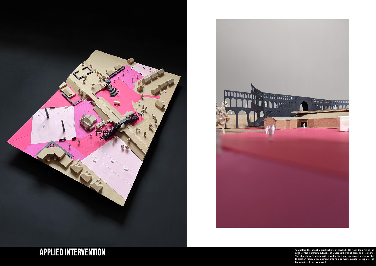
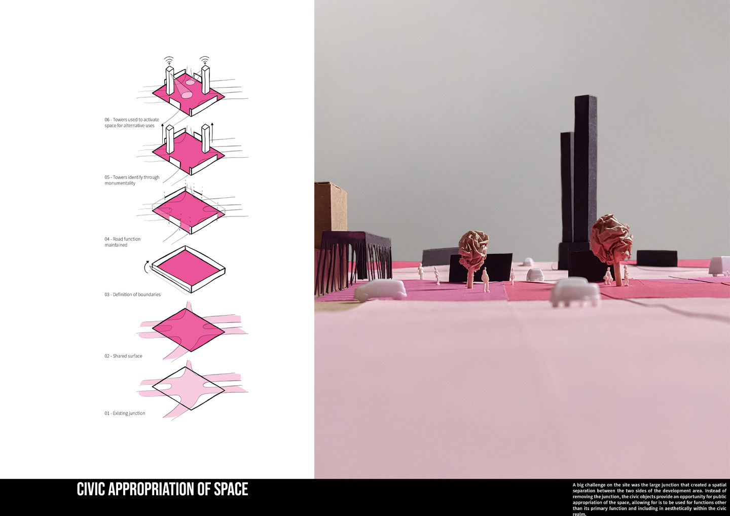
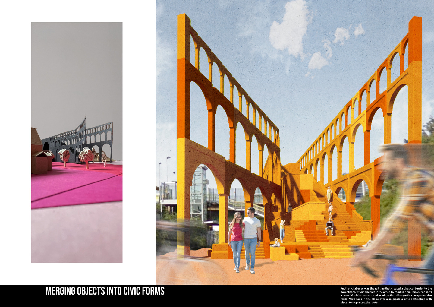
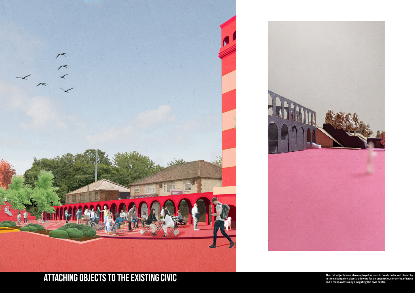
The Dispersion Development Corridor is a kit of civic strategies designed to create a civic hierarchy in a network of local and district centres, organise civic asset improvement and create a platform for new, dispersed urban development that will gradually transition the urban structure towards one of social, economic and environmental balance.
Building on a deep mapping analysis of the M58 corridor using GIS analytics tools to assess the characteristics of what we defined as a 'Dispersed city' we developed a dispersion index. This formed the basis of our individual proposals for urban restructuring by revealing patterns within the existing structure and areas for improvement. The dispersion development corridor is proposed as a live framework with multiple scales of intervention that outline a slow, organic shift towards a multi nodal urban structure, kickstarted by catalytic civic interventions. These civic additives are proposed as a means of building a more dispersed civic identity that prioritises the local over the regional and acts as an anchor for future developments. Immediate interventions are designed to create a civic aesthetic in the predominantly suburban and rural existing centres. The medium-term strategies outline the future development of the civic assets within the local centres from the hard assets (buildings and streets) to the soft assets (civic programming and functions), filling the void left in the local by the declining physical presence of retail. The long-term dispersion strategy is to ensure that the development corridor’s civic offering maintains a full spectrum of civic offerings expected of a traditional city despite their balanced distribution.