My interests lie in research-driven methodologies which have shaped my projects throughout my masters. These include investigations into the wider contexts that shape the built environment including colonialism, Brexit, representations in mass media, local policies and the UK planning system.
URSA
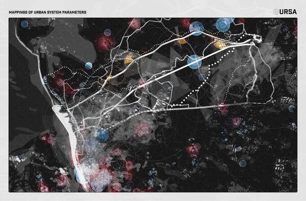
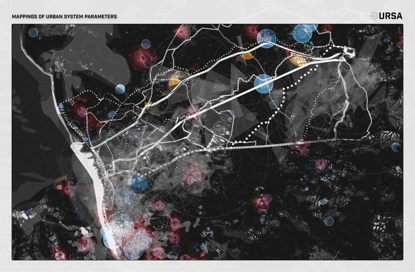
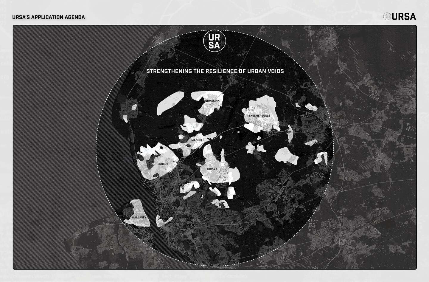
Topics synthesised from contemporary literature of the urban system were investigated through collaborative mapping exercises of areas surrounding the M58. Cartographic features from mapping overlays revealed 'Urban Voids' defined by zones neglected/lacking in specific parameters of the urban system. Research into the policy system led to the conclusion 'The policy system is unresponsive to the ever-changing, complex and interconnected nature of the urban system', demonstrated by current outdated policies and legislations that do not reflect the current needs of the urban system, resulting in inefficient decision-making.
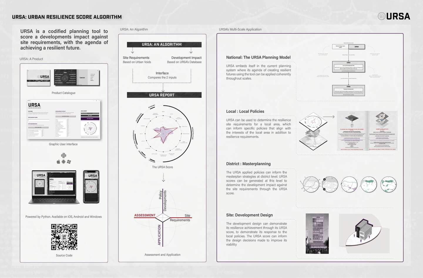
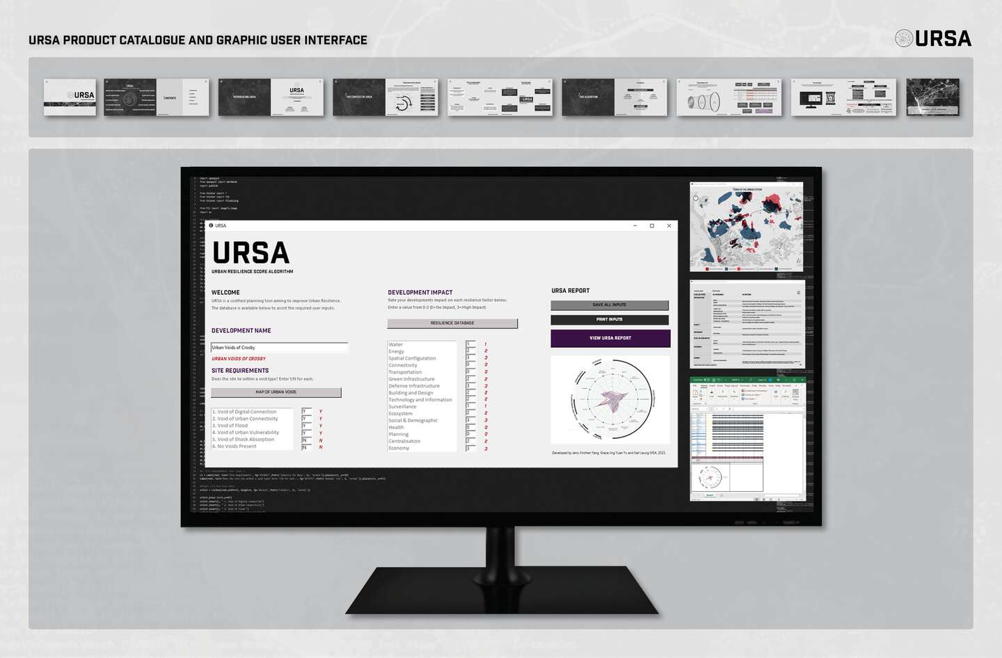
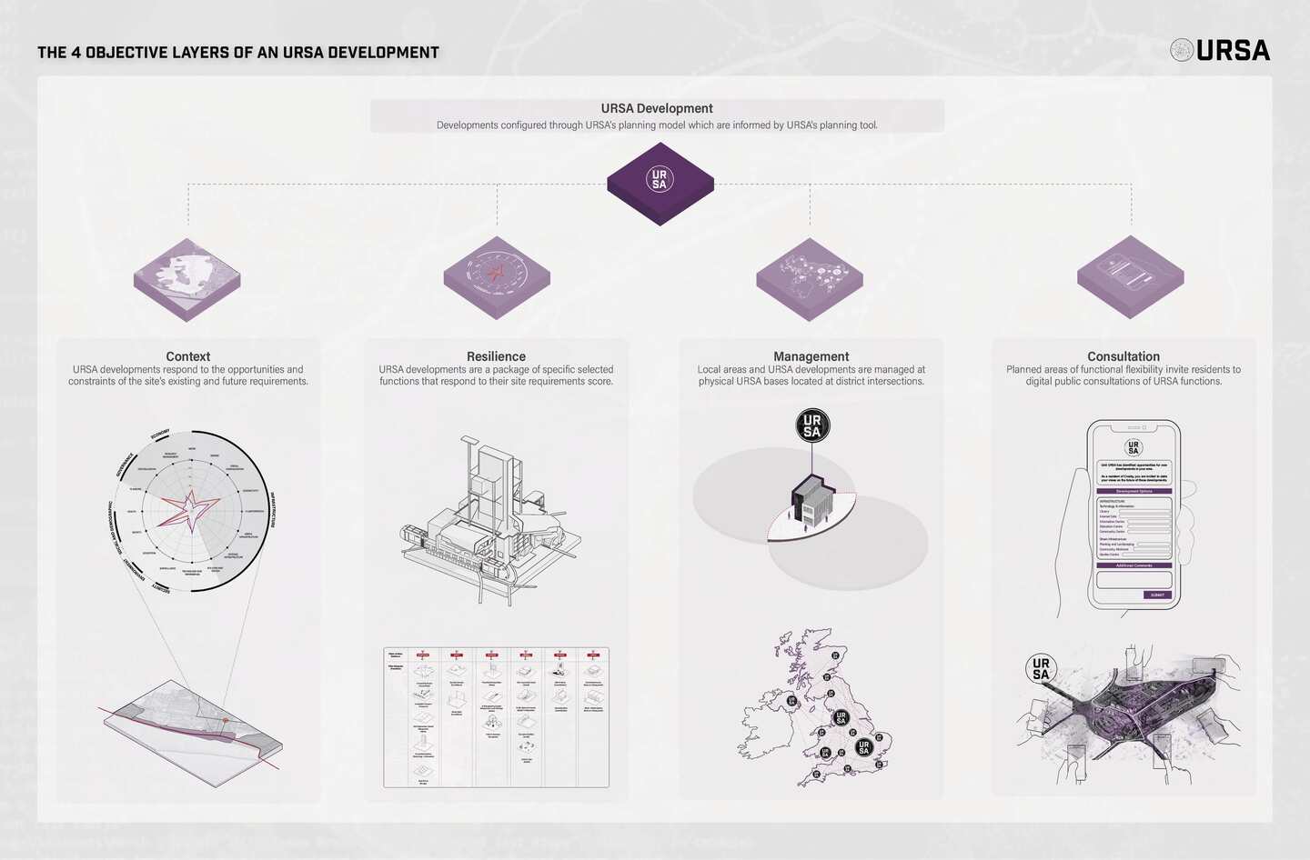
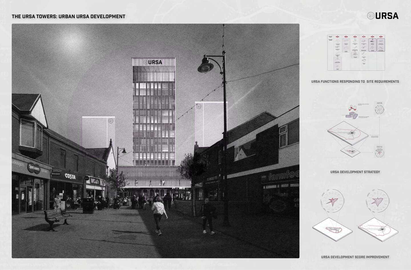
URSA is a codified planning tool, with the agenda of improving urban resilience. URSA responds to the complex nature of the urban system and the need for computational methods in planning decision-making. Using a zonal map of 'Urban Voids' and a 'Resilience Impact' database, URSA can score a development's impact against its site requirements.
URSA was developed in collaboration with Jerry Xinchen Yang and Karl Leung
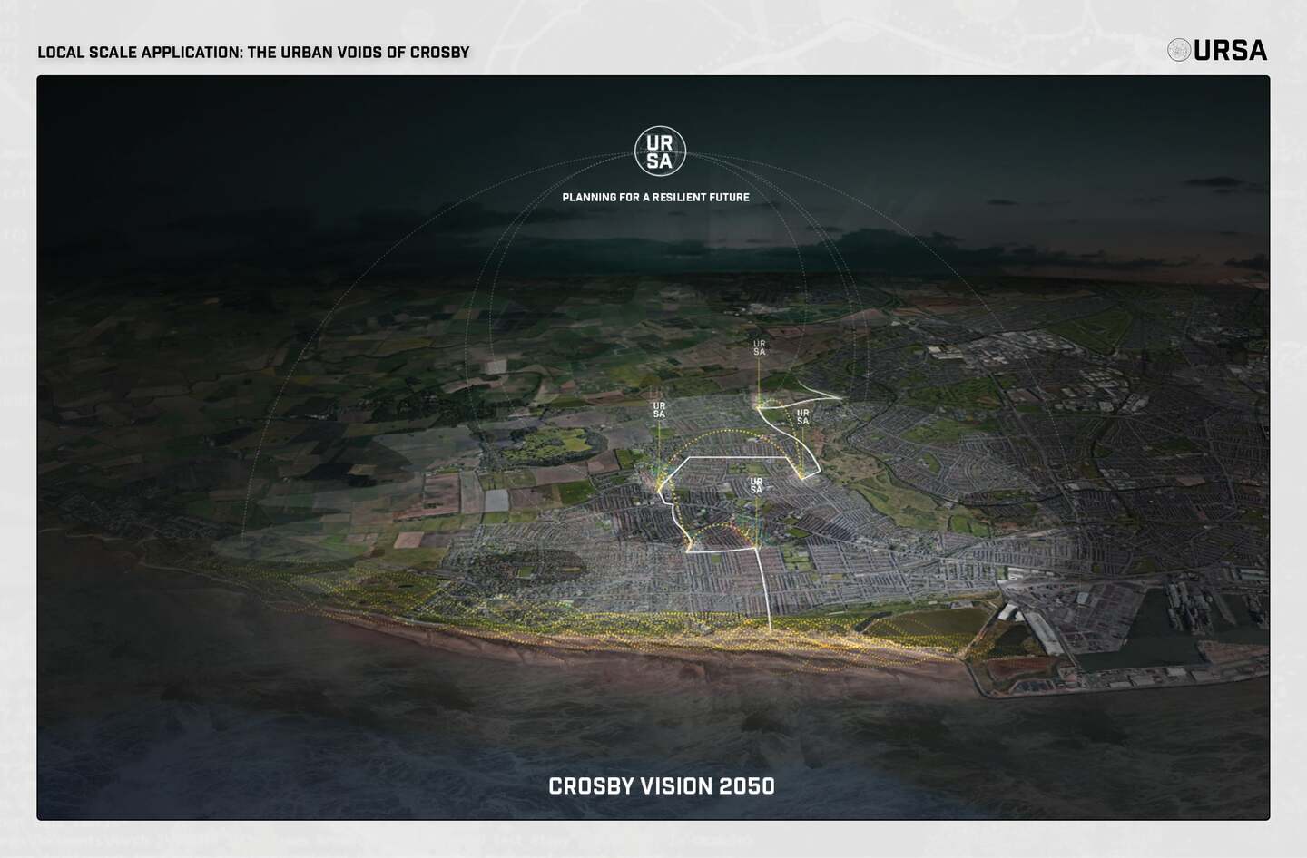
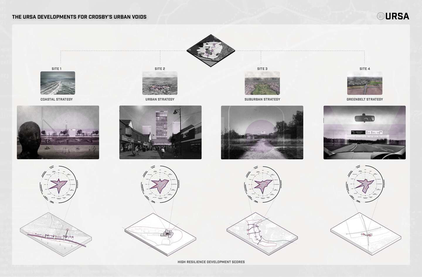
Planning for a Resilient Crosby
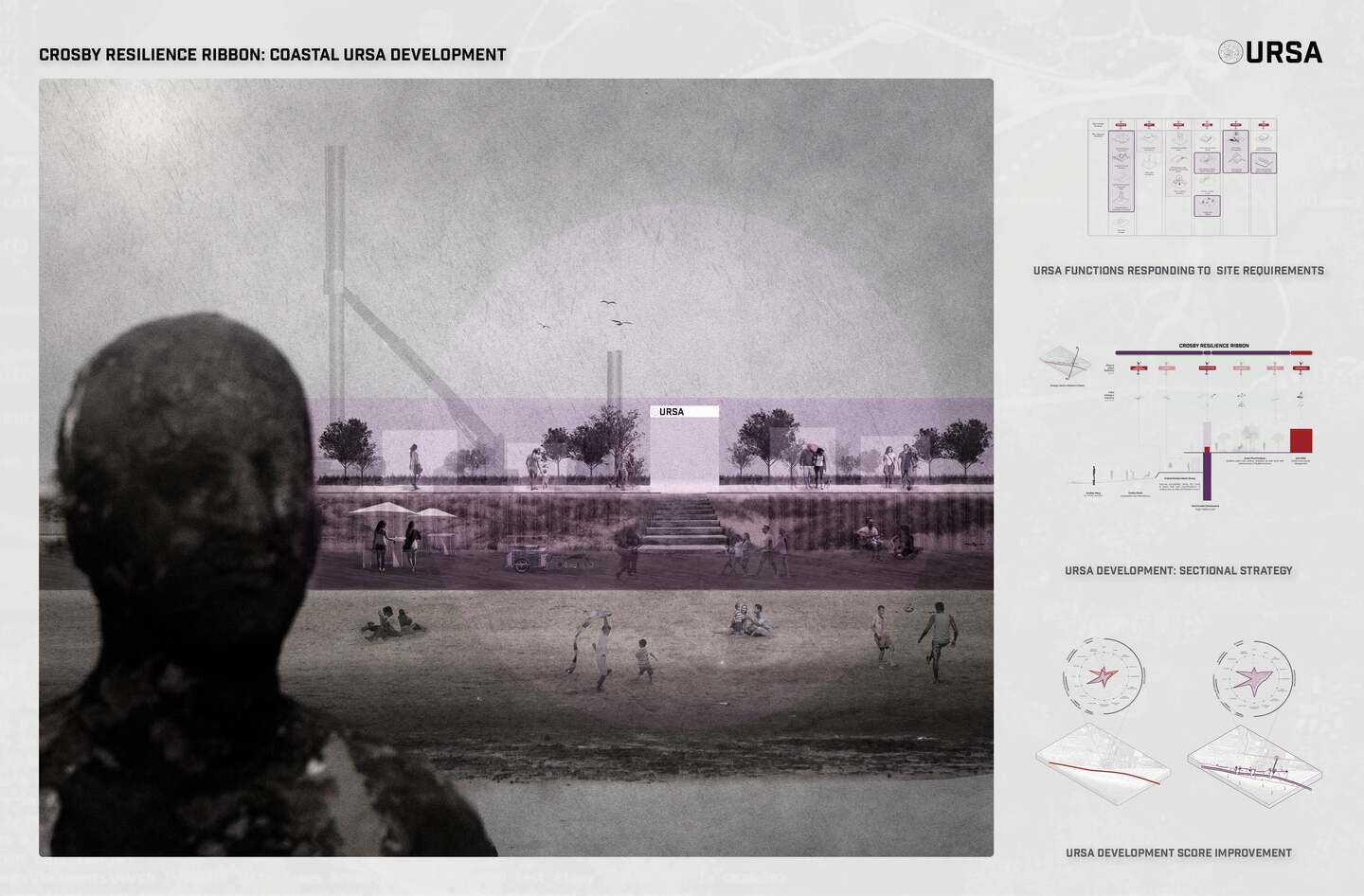
URSA's multi-scale application is demonstrated on the local scale test-bed 'The Urban Voids of Crosby'. 4 sites are determined at district level by their urban typologies: the coast, urban centre, suburban and greenbelt location. Proposed are 4 URSA developments that respond directly to their URSA site requirements through a methodology of strategic planning informed by URSA, to propose 4 site scale developments with improved resilience URSA scores.