Code of Floods
My work explores how computational design and systems thinking can reframe the urban response to climate breakdown. Rooted in East Manchester, my thesis project Code of Floods investigates how cities can evolve not by resisting flood, but by adapting to it. In an era of stalled climate action and intensifying rainfall, the project uses flooding as a lens to develop a transferable computational model, one that enables any flood-prone city to prototype adaptive, resilient, and ecologically integrated urban futures.
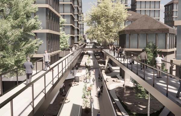
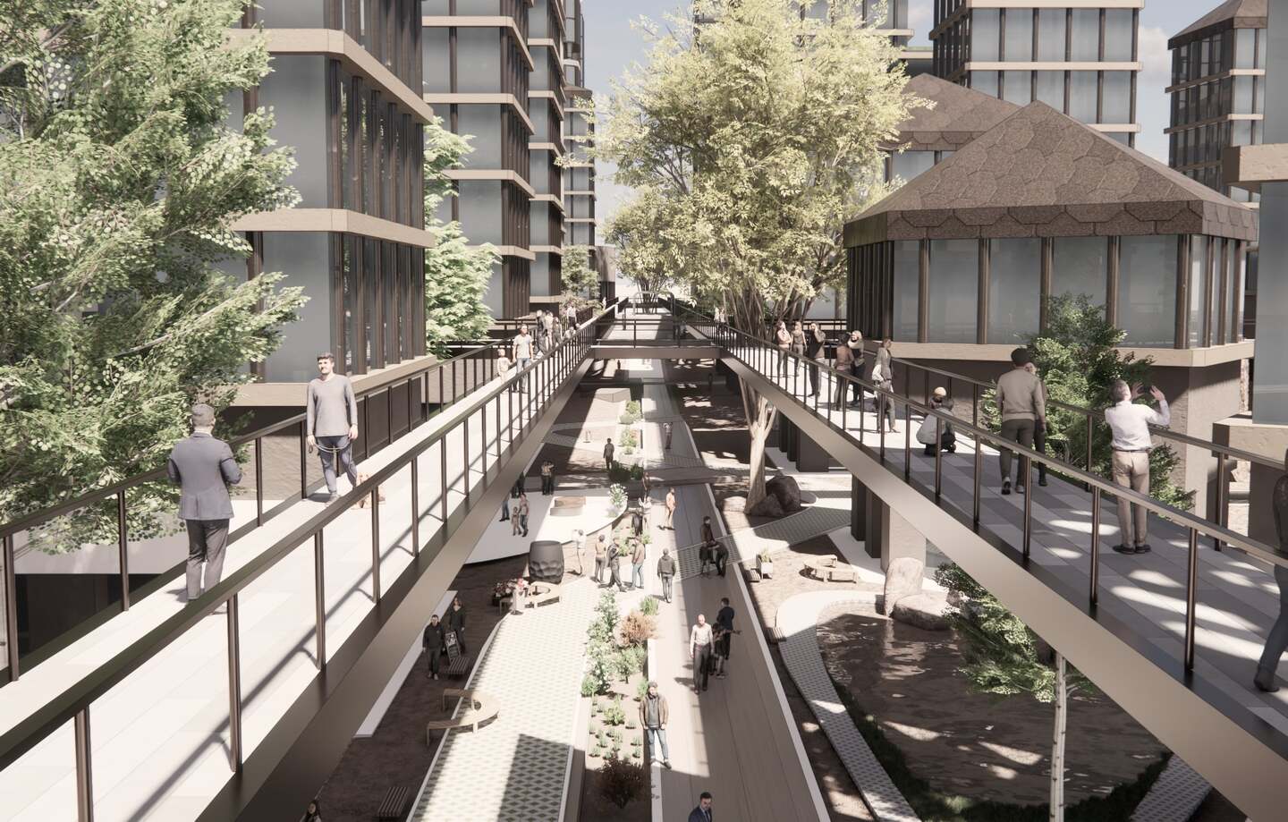
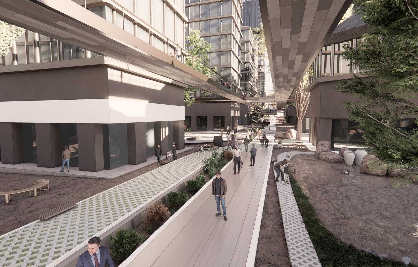
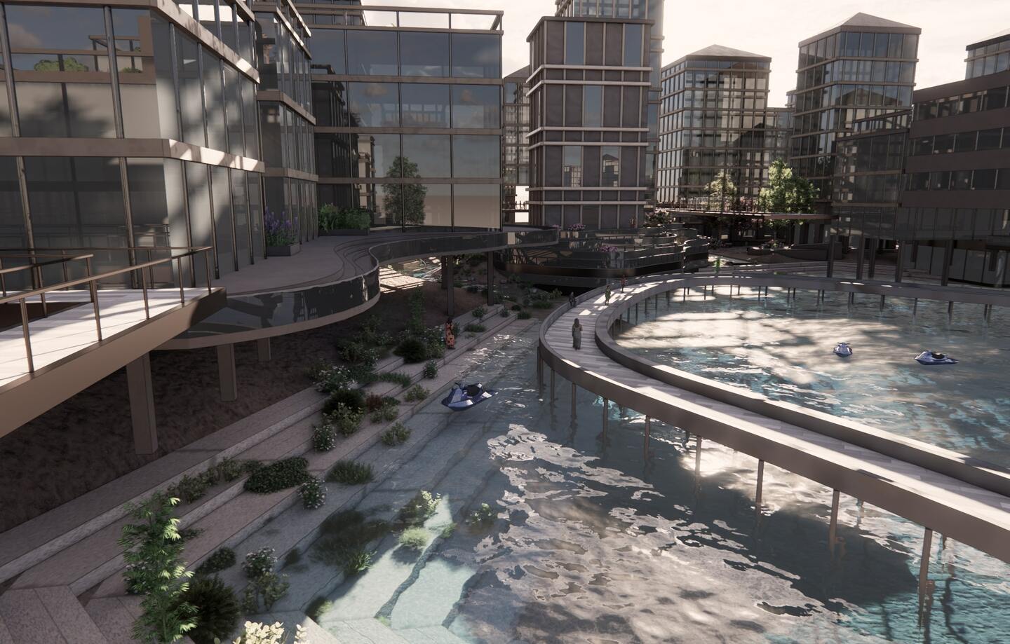
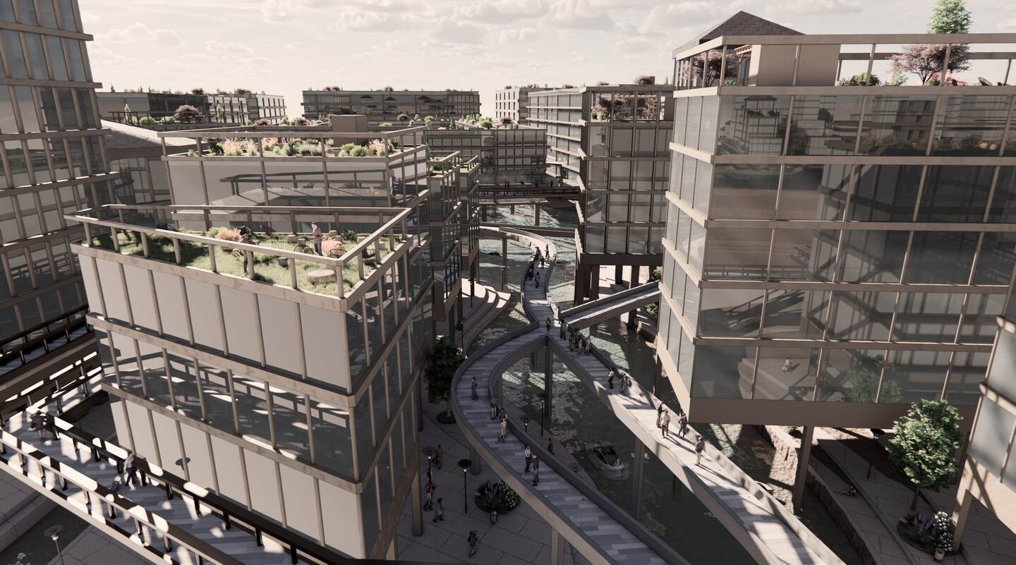
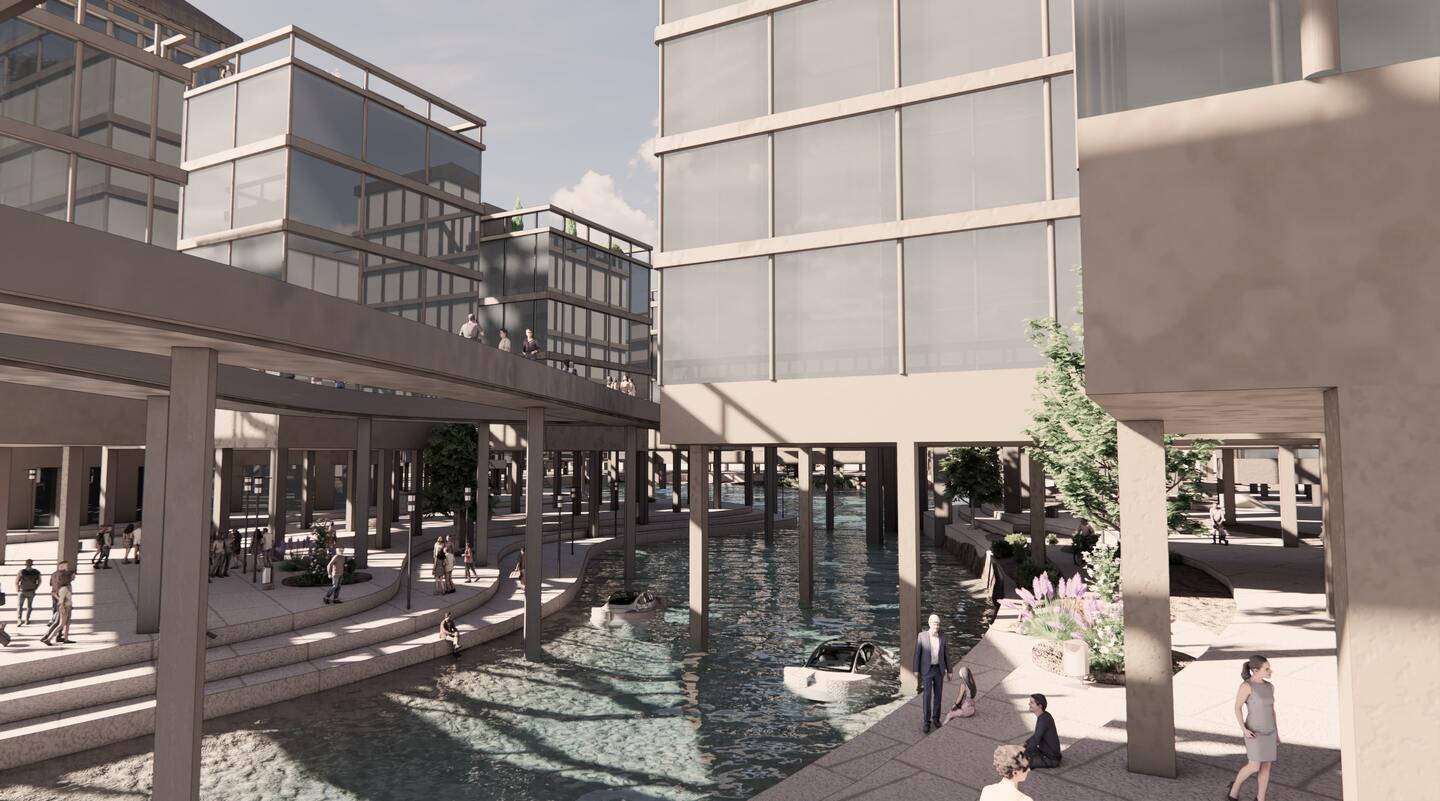
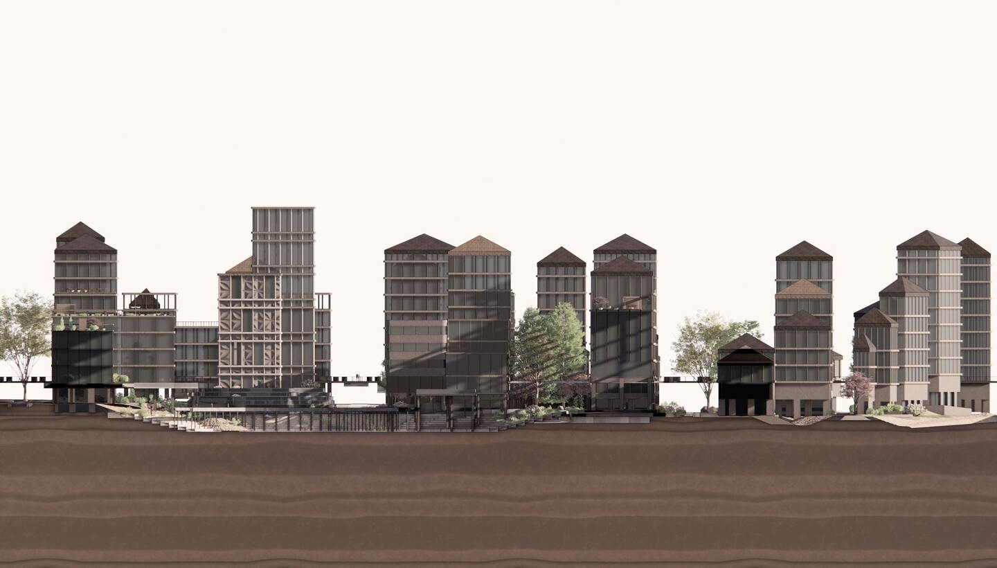
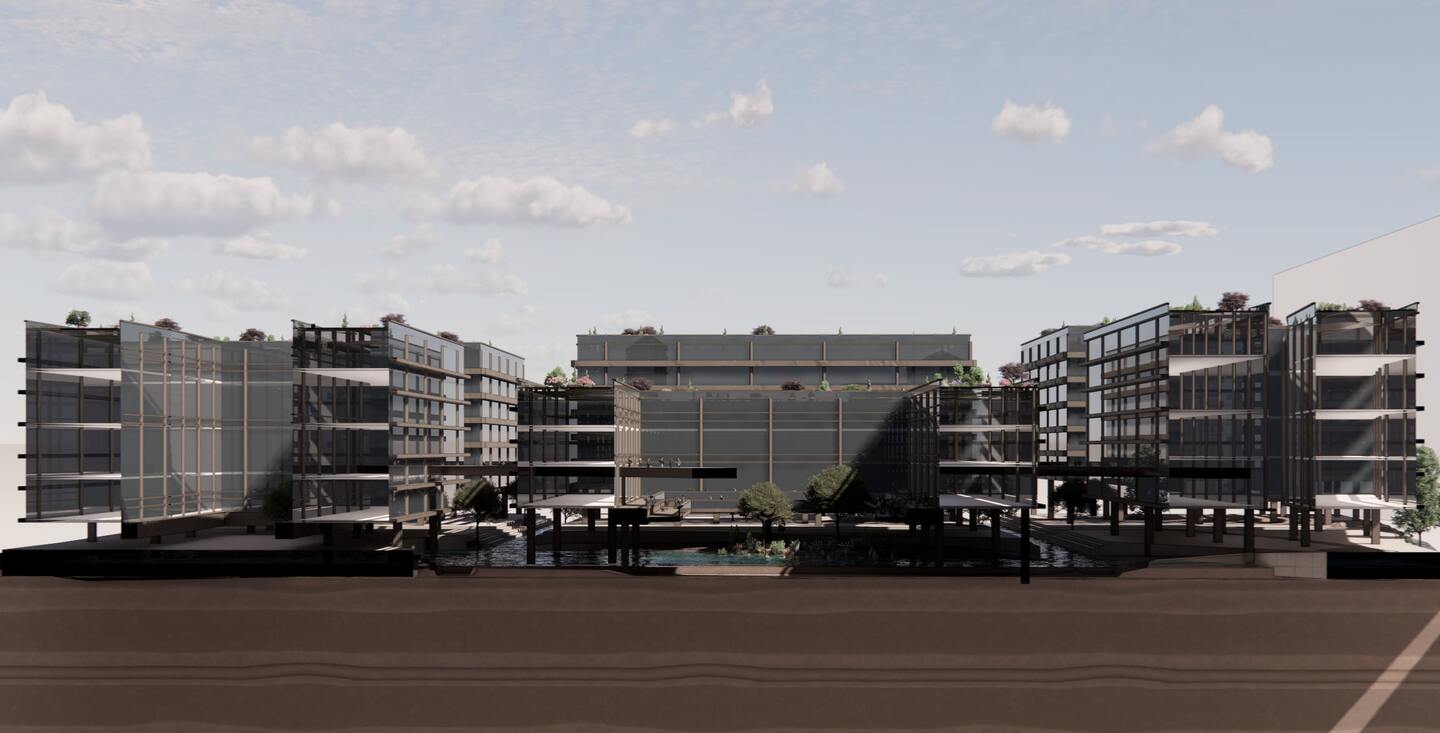
Drawing from complexity theory and resilience frameworks, I developed a computational methodology that links terrain, hydrology, and socio-political conditions into dynamic urban systems. This work culminated in a spatial strategy and digital design tool capable of simulating urban transformations under future flood scenarios. By incorporating adaptive street networks, water-sensitive land use strategies, and adaptive building typologies, the proposal seeks to rewire urban infrastructure to not just survive, but regenerate through environmental disruption.
The overarching aim is to design urban systems that operate in dialogue with their spatial and ecological contexts. By leveraging feedback loops, emergent spatial patterns, and real-time environmental data, the project promotes a design practice grounded in adaptability and contextual intelligence. Rather than offering a prescriptive masterplan, Code of Floods presents a toolkit of spatial strategies, configurable and scalable across diverse geographic contexts, that redefines resilience as an ongoing process of spatial negotiation and transformation.
Through iterative computational design, this work demonstrates how urban form can be reoriented around flood regimes, repositioning floodplains as assets rather than liabilities. In doing so, it advocates for an urbanism that is not only resilient, but also regenerative, capable of coexisting with, rather than against, natural systems.